 Membership
 Donate


A Trail to Two Peaks
How the creation of a hikers’ highway on Longs Peak changed the face of one of Colorado’s most famous mountains.
Editor's note: This article was adapted by the author for The Colorado Magazine from an essay submitted to the Emerging Historians Contest.
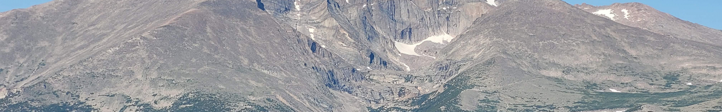
For more than a century and a half, Longs Peak has lured adventurers dreaming of conquering its glacier-carved granite summit. Soaring to 14,256 feet and eclipsing all surrounding mountains, this prominent peak inspired awe and gained fame as the “American Matterhorn” and “Monarch of the Rockies.” To an observer gazing across the rugged northern Front Range mountains from Denver International Airport, one peak stands out, dwarfing all others. But this is Mount Meeker. Longs Peak is concealed by its less illustrious neighbor.
A cultural chasm developed between Longs Peak and Mount Meeker over the last two centuries, wider and deeper than their actual geological divide. The two peaks are connected, both part of the same mountain, though Longs Peak rises a mere 344 feet higher. Called Nesotaieux, “The Two Guides,” by the Arapaho, and Les Deux Oreilles, or “Two Ears,” by French fur trappers, the two peaks were perceived by early viewers as belonging together and being of roughly equal importance. Each peak offered the same formidable challenge to daring hikers attempting to conquer its summit. Yet, by the late 1970s Mount Meeker remained trailless, tempting only a handful of technical hikers a year, in stark contrast to the thousands clogging the trail up Longs Peak.
This contrast between the two neighboring peaks can help us reframe how we conceptualize national park geography. Historians of Rocky Mountain National Park, such as C.W. Buchholtz, Jerry Frank, and Ruth Alexander, have distinguished between the frontcountry—easily accessible park areas and amenities along roads, and the backcountry—remote park areas reached on foot or horseback. Most include Longs Peak as part of a monolithic backcountry. But contrasting it with Mount Meeker reveals a more complicated story, blurring the simple frontcountry and backcountry divide. The average recreationist, unskilled in rigorous trailless travel, must choose outdoor locations carefully to truly escape the commotion of modern life. Merely heading for “the backcountry” is not enough.
The difference is in the trails. Trails allow a much deeper encroachment of human development into the backcountry than first appears. But over the years, the construction, development, and modification of trails on Longs Peak created a hikers’ highway, bringing tens of thousands to the summit—especially notable in contrast to neighboring Mount Meeker, which was left relatively untouched.
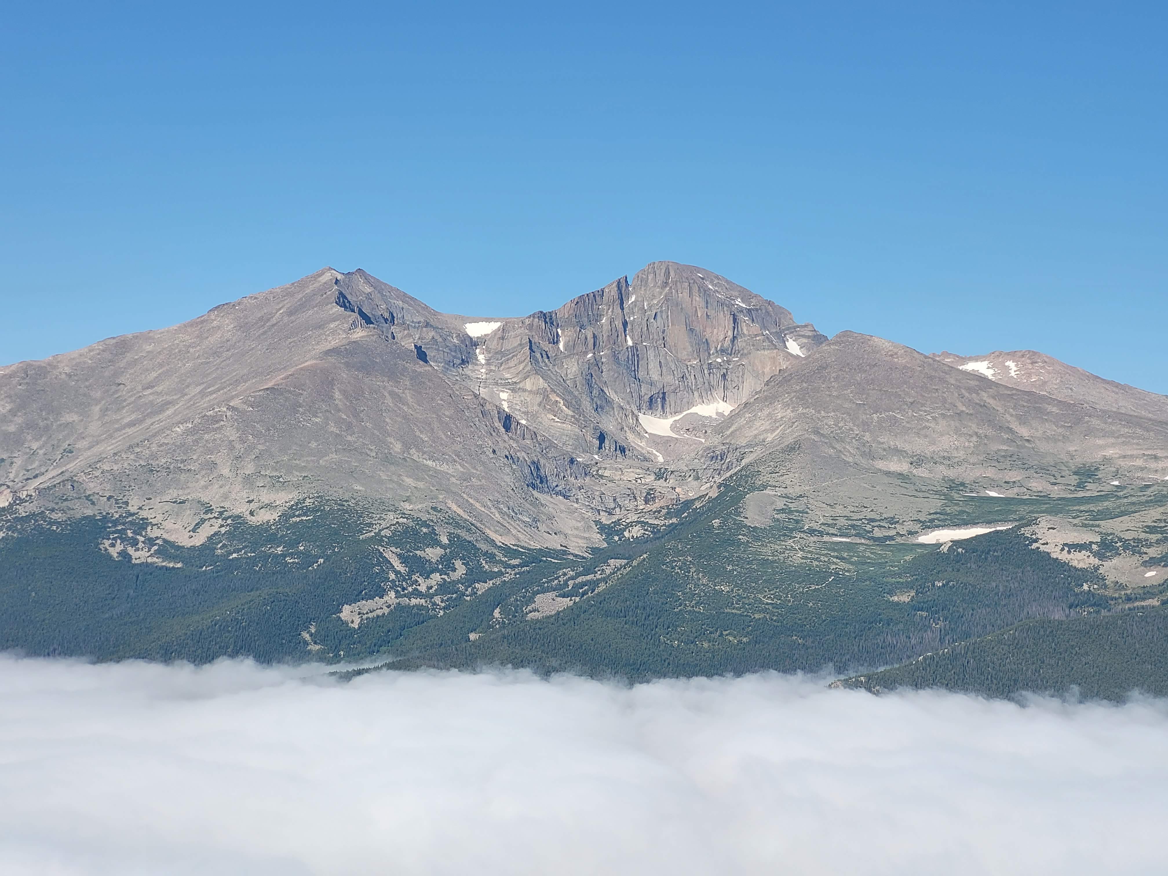
The twin peaks of Longs Peak (right) and Mount Meeker (left) are clearly visible from across the valley atop Twin Sisters Peaks. Photo taken by author, July 12, 2025.
Blazing a Trail
The names of Longs Peak and Mount Meeker both derive from early Anglo-American visitors to the region. Longs Peak is named after Major Stephen Harriman Long, who led an 1820 exploratory expedition across the Great Plains. The expedition’s journalist, Captain John R. Bell, recorded what is credited as the first written account of viewing Longs Peak on June 30, 1820, noting “a high Peake was plainly to be distinguished towering above all the others as far as the sight extended.” Despite Major Long never setting foot on the peak, the mountain was named after him.
Mount Meeker is named in honor of Nathan Meeker, a newspaper editor who founded the Union Colony at present-day Greeley and who played a significant role in the removal of the Ute from Northern Colorado. In 1878, Meeker was appointed Indian agent of the White River Agency, a Ute reservation in northwest Colorado, and, like many contemporary Euro-American settlers, Meeker regarded the Utes as inferior, primitive, and savage, and sought to convert them to a sedentary life as farmers. Meeker’s cruelty, incompetence, and heavy-handedness, which included withholding rations as punishment for Ute refusal to follow his policies, caused increasing enmity. Fearful of Ute unrest, Meeker requested the aid of federal troops, which was seen by the Utes as a declaration of war and resulted in Ute warriors setting fire to buildings and killing all of the white male employees at the agency, including Meeker. Following the Meeker Incident, the army forcibly removed the White River and Uncompahgre Utes to the Uintah Reservation in eastern Utah in 1880. The removal of the Utes, the earliest Tribal group of the historical period to live in the area that became Rocky Mountain National Park, marked the final and almost-complete displacement of all the Native Americans in northern Colorado from their homelands.
Early excursions by white travelers to the peaks occurred against this background of displacement and territorial expansion, but their descriptions of the trip rarely reflected that. Instead, they highlighted the rough terrain, difficult climb, and natural beauty.
The hiking experiences on Longs Peak and Mount Meeker were initially identical: rugged, routeless, and remote. William Byers, editor of the Rocky Mountain News, described the ordeal of reaching Longs Peak’s base in 1864. He called the primitive road up the Big Thompson Canyon “quite rough; rocky and hilly.” With no trail to guide them, Byers’s group attempted multiple ascent routes before choosing a southern approach and making “the summit of the east peak,” the notably subordinate (and then nameless) Mount Meeker. Byers concluded they “were as far as man can go.”
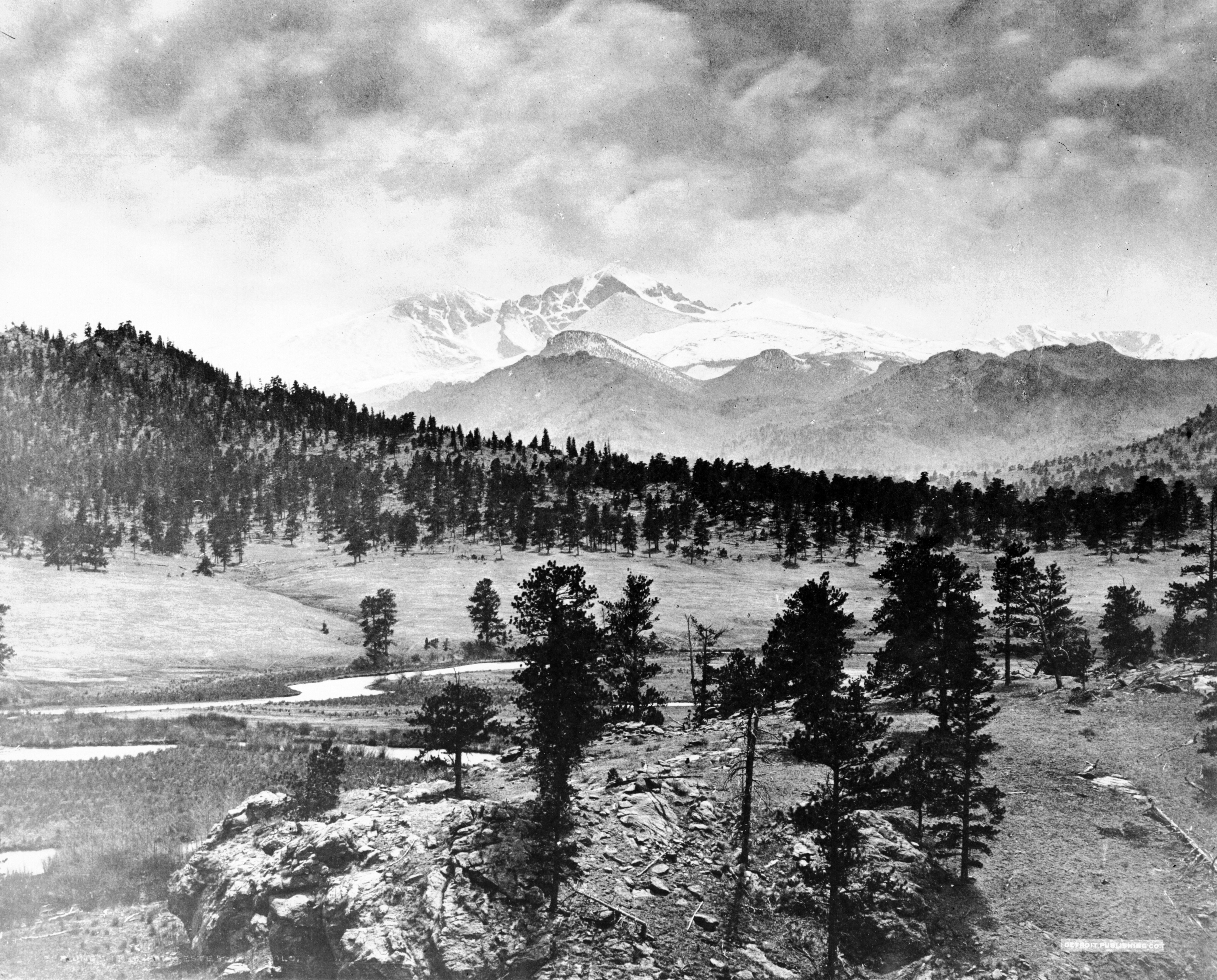
Longs Peak from Estes Park. Photographed by William Henry Jackson, circa 1880-1900.
He returned four years later with the John Wesley Powell expedition and proved himself wrong. Over five days, the party of seven proceeded on horseback from the “west sides of Grand Lake,” camped near the timberline each night, and after multiple attempts successfully climbed Longs Peak’s summit from the south. To avoid the convoluted route, which demanded repeated backtracking and skilled route-finding, would require the construction of a trail.
In 1871, the Rocky Mountain News still advertised “the best…ascent of Long’s [sic] Peak…is southward, passing around the east foot of the mountain to the south face.” The 1873 Hayden Expedition, however, approached Longs Peak from “first north and then northwest, around the wide base of the great mountain,” and found there an existing trail which was “well blazed, and leading in the direction we wanted to travel.”
The party followed what’s now known as the Keyhole Route, camping at Jim’s Grove near timberline, leaving the horses at the Boulder Field, passing through a “notch,” trough, and “narrow shelves,” and then making the final homestretch to the summit.
British explorer Isabella Bird followed the same route just a few weeks later, camping at the timberline, passing “an expanse of large and small boulders” and “the notch” to the summit. This informal trail shortened the ascent to two days, with an overnight camp at the timberline, although hikers still rode horseback as far as the Boulder Field.
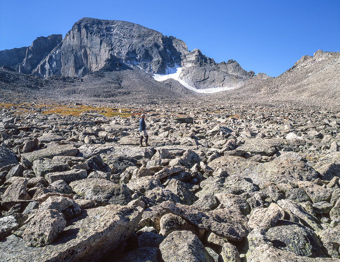
The Boulder Field and Longs Peak. Photo by John Fielder, 2015.
The development of that informal trail up Longs Peak in the 1870s had a profound impact on early hikers’ experiences on the peak. In 1875, the Reverend Elkanah Lamb opened the Longs Peak House near the base of the peak and constructed a toll road connecting it to Estes Park, accommodating hikers and shortening their ascent up the peak. In 1878, Lamb and his son Carlyle started the first guiding business on the peak, charging five dollars per trip, and created an informal pony trail from their resort to provide hikers an easily accessible route to Jim’s Grove campsite.
Enos Mills took over the Lambs’ guiding business in 1902, renaming it the Longs Peak Inn. Mills transformed the Lambs’ informal pony trail into the East Longs Peak Trail, with Shep Husted, a fellow Longs Peak guide. In promotional materials Mills highlighted the new trail’s impact, writing that it tempted “all grades of climbers to try for the top. Old, young, rich, poor, poetical and practical,” and opened the summit to more hikers. By 1885, climbing Longs Peak was no longer a newsworthy feat and by 1915, hundreds ventured up the mountain each year, three quarters of whom were guided. Mills alone took thirty-two parties up Longs Peak over the month of August 1906.
A stark contrast had already developed between Longs Peak and its neglected neighbor Mount Meeker. In 1908, Mills built Timberline Cabin near Jim’s Grove, the first hut on the mountain, offering hikers the luxuries of a “kitchen and two sleeping rooms with bunks.” By 1919, ascending Longs Peak typically entailed boarding at one of the adjacent hotels, embarking on a well-maintained trail, an overnight stay at Timberline Cabin, and a guided summit climb the following day. While Mount Meeker had the same surrounding resorts and road access as Longs Peak, it lacked a trail to the top. Artist and ranger Dean Babcock described Mount Meeker as “overshadowed by its slightly higher and far more famous companion” with only a few reaching its summit because its routes demanded “hours of tedious climbing over fallen timber and monotonous debris slopes.”
In contrast, the Timberline Cabin was only the most recent in a string of steady developments on Longs Peak, and it ushered in a new era for the mountain.
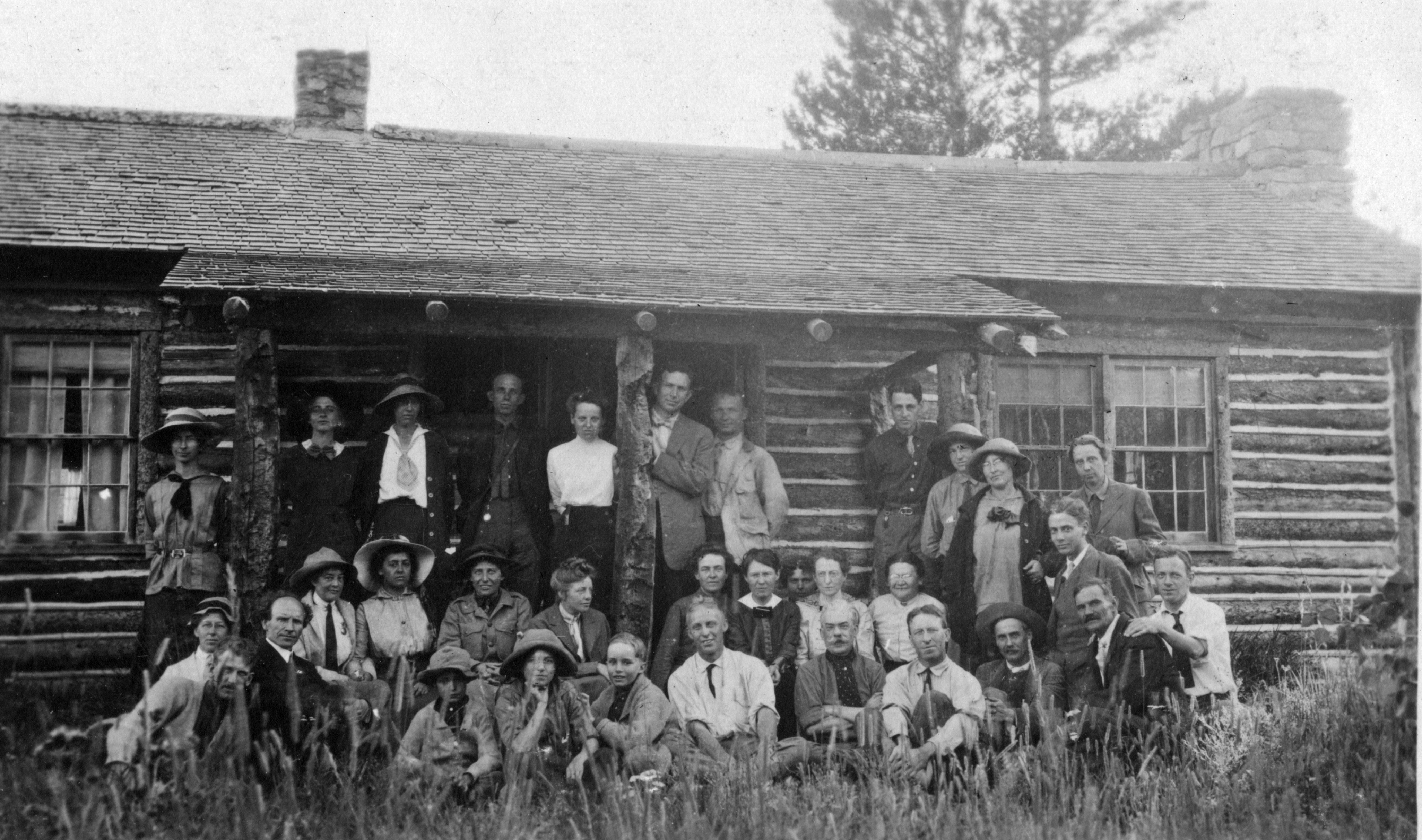
Colorado Mountain Club members posing outside the Longs Peak Inn, which was located outside of Estes Park and served many hikers on their way to the nearby summits of Rocky Mountain National Park.
The Hikers’ Highway
After 1915, Longs Peak was part of the newly minted Rocky Mountain National Park. Federal ownership brought a surge in development along the East Longs Peak Trail, which fell under the National Park Service’s dual mandate to preserve natural scenery and provide visitor enjoyment. By the 1920s, the park had sufficient funds for significant backcountry management, and began to make major changes. In 1921, the trail section between Jim’s Grove and Granite Pass was improved, with the Estes Park Trail reporting the gradient was reduced from “30 to 40 percent” to “an easy 15 percent” and deliberately designed to “suffer the minimum damage from rains and melting snows.” The trail improvements reflected new National Park Service (NPS) trail-building standards and enabled hikers to make “quicker time and with much less fatigue.” The new trail was so smooth that ranger Dwight McDaniel made “the ascent unaided on a motorcycle nearly to [the] timberline.” Park Superintendent Roger Toll ordered colored discs painted along the rugged trail between the Keyhole and the summit in 1922, to direct hikers and prevent them from getting lost. This escalation in development along the trail marked the first step in creating a hikers’ highway to its summit. Already by 1921, the Estes Park Trail reported 1,004 people had climbed Longs Peak, “over half of them without the aid of guides.” But then an unexpected tragedy escalated the development on an unprecedented scale.
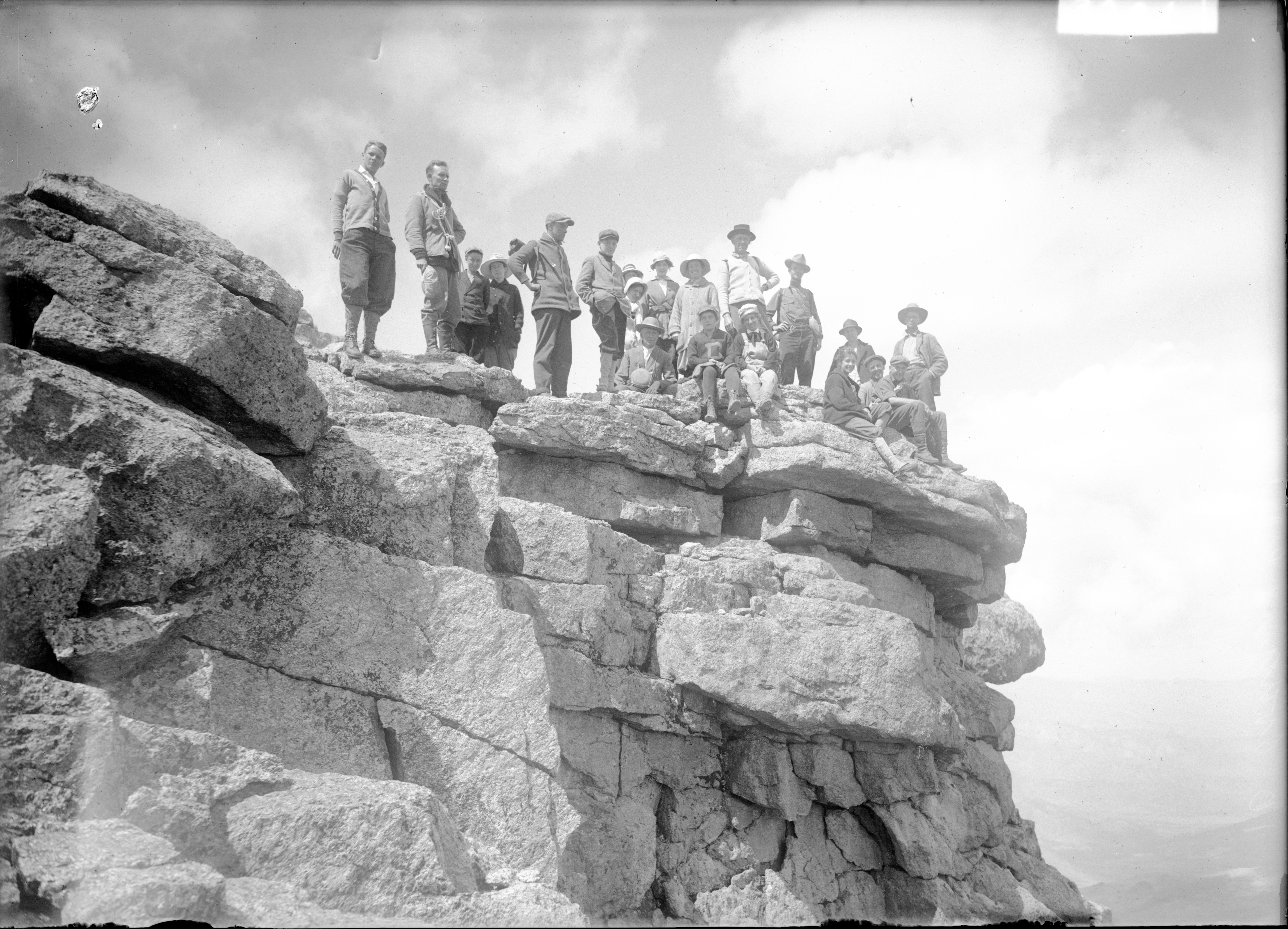
In 1925, Agnes Vaille died climbing Longs Peak. She’d fallen while descending the peak’s North Face cliff amidst a severe winter snowstorm, and, while only sustaining light injuries, died from hypothermia before rescuers reached her. While several previous fatalities had occurred on the mountain, Vaille was a skilled mountaineer, member of the Colorado Mountain Club, and Superintendent Toll’s cousin. Her tragic death made news across the state and increased efforts to make the climb more safe, accessible, and scenic.
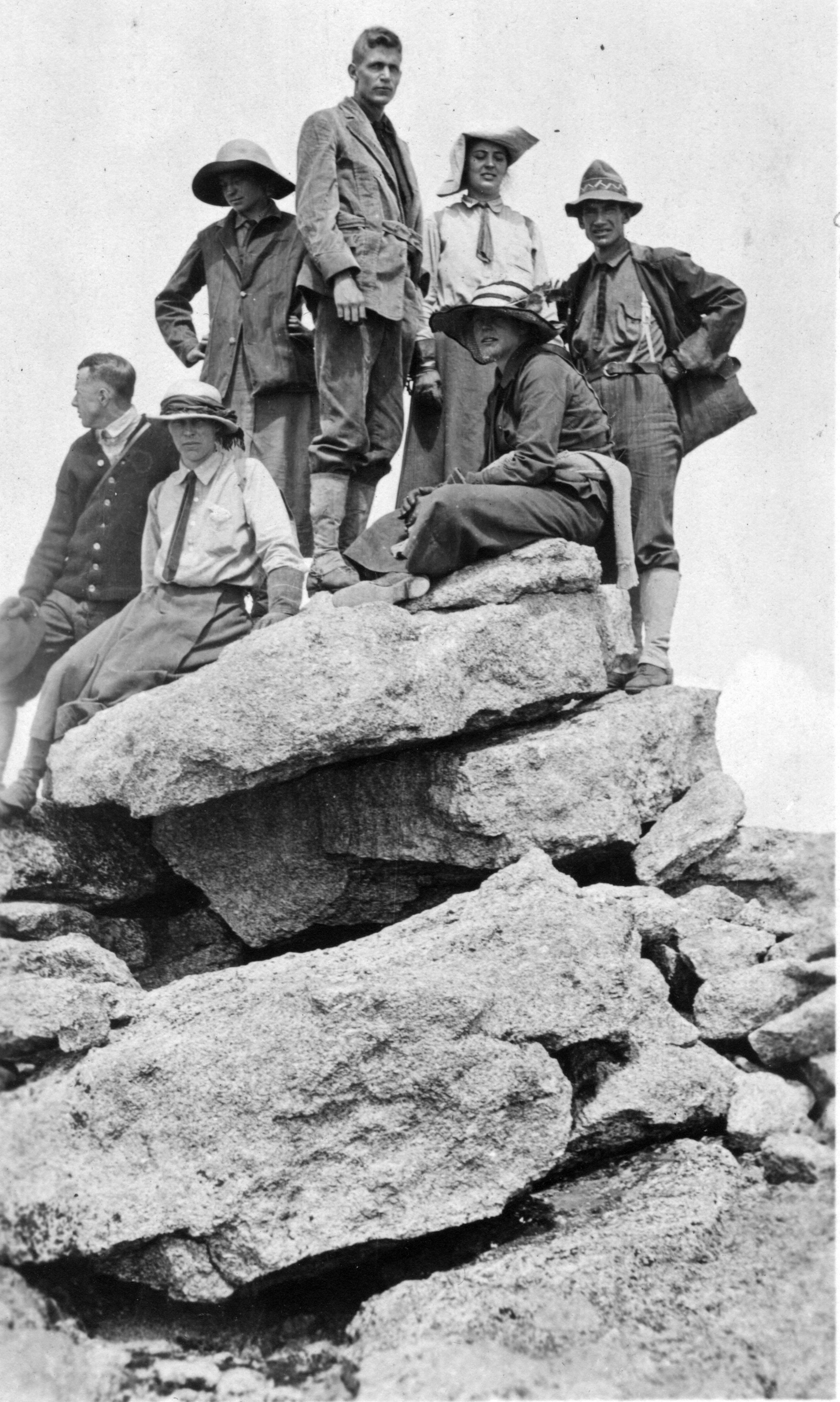
A group of hikers from the Colorado Mountain Club at the summit of Longs Peak, 1913. Agnes Vaille is the third from the left, standing and wearing a wide-brimmed hat.
Later that year, ranger Jack Moomaw and his crew installed two steel cables onto Longs Peak’s North Face, the cliff Vaille had fallen from, to provide climbers a handrail for ascending the peak and make the route safer. Moomaw recalled drilling holes into the rock and “cemented eyebolts into the holes” to install the cables, permanently altering the mountain. The telephone line to Timberline Cabin was extended “to the center of the Boulder Field,” enabling a faster search-and-rescue response. Moomaw also improved the trail section between timberline and the Boulder Field, constructing switchbacks which reduced the trail gradient and lengthening the horse-accessible trail to a hitching rack in the Boulder Field accommodating “twenty-five or thirty horses.” Moomaw followed NPS trail-building standards and masked the environmental harm wrought during construction, recalling the new trail “looks as though it has always been there” despite requiring more than two tons of dynamite to build it. Superintendent Toll praised the new trail’s “excellent views” and the Estes Park Trail lauded the new Cables Route for shortening the climb of Longs Peak “by about an hour,” providing “some remarkable views,” and enabling “a circle trip.” For the first time, Longs Peak had two non-technical trails to its summit, allowing hikers to climb and descend in a loop. In September 1925, the first hikers completing the Cables Route were “very enthusiastic over its scenic attractions.” While safety was clearly Toll’s paramount concern, he also sought to fulfil the NPS’s mandate by enhancing the trail’s accessibility and scenic views to attract more hikers and provide them a more enjoyable experience.
Considerable trail development continued throughout the rest of the 1920s. A new trail to Chasm Lake, located in a glacially-carved bowl surrounded by steep granite cliffs, provided easy access to “one of the most spectacular regions of the park,” according to the Estes Park Trail. In 1927, the Park built the conical Agnes Vaille Memorial Shelter Cabin beside the Keyhole with native stone, adhering to NPS rustic-design standards and blending into the surrounding Boulder Field. Although primitive, the structure provided hikers shelter from Longs Peak’s frequent high winds and sudden storms. The Boulder Field Shelter Cabin opened the same year, offering hikers paid accommodation, twelve bunk beds, an outside latrine, and a horse stable. Robert Collier Jr. operated the cabin, and from him hikers could hire guides and purchase “coffee or sandwiches,” more substantial meals, or “use the cabin for an overnight stop,” with pack horses carrying in supplies. Guides took parties to the summit two to three times a day in summer, and hikers staying overnight no longer needed to carry their own food, fuel, and bedding supplies. The cabin resembled an Alpine hotel, hosting between two and three hundred hikers during the summer, and the Estes Park Trail no longer considered Longs Peak “untouched by man.” Although the cabin was removed in 1937 due to the ever-shifting Boulder Field causing structural issues, it marked a further advance in human development on Longs Peak.
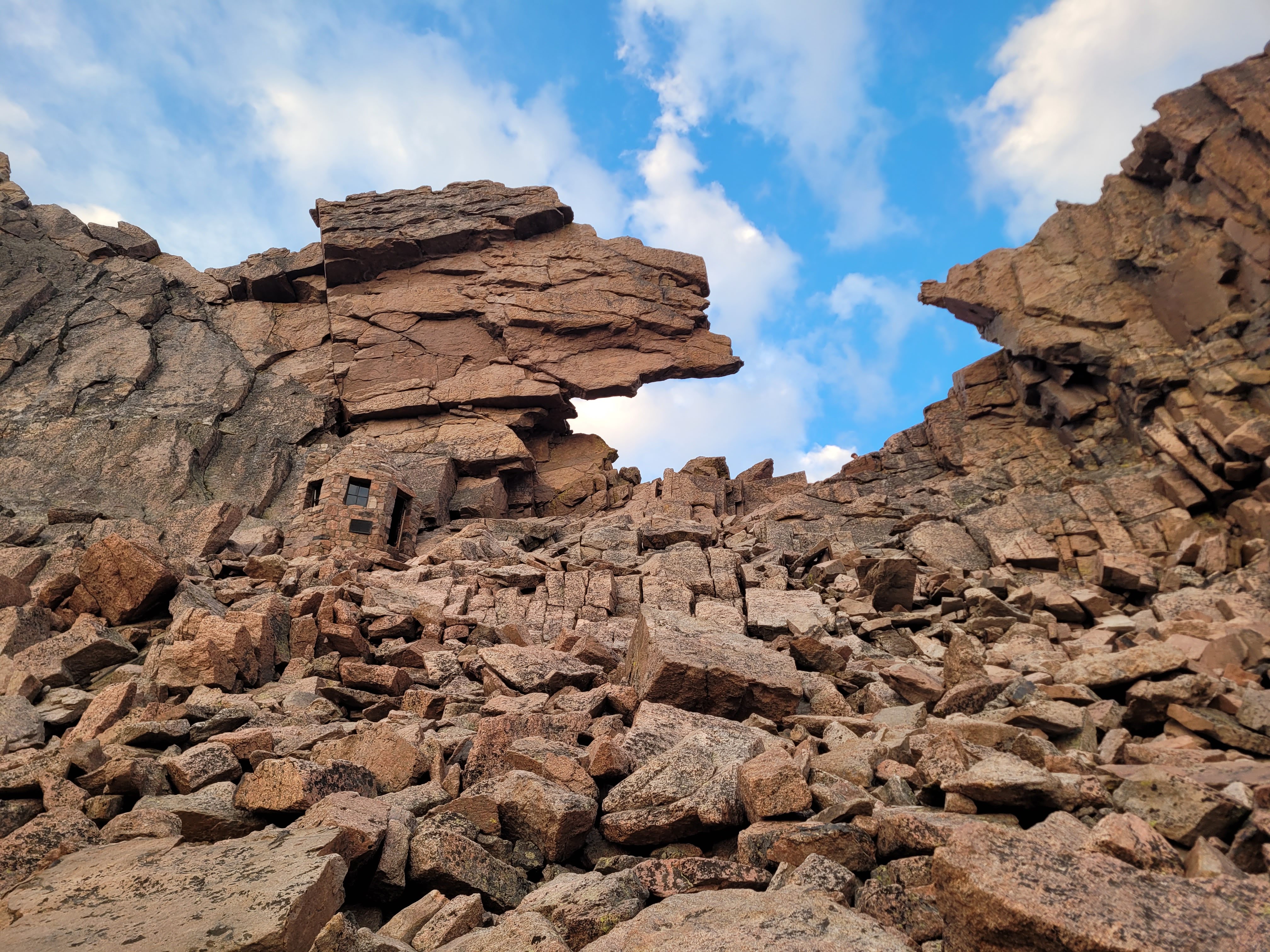
The Keyhole of Longs Peak with the Agnes Vaille Memorial Shelter (center left) blending into the surrounding rocky scenery. Photo taken by author, August 10, 2025.
Individually, each of these trail developments was a significant change, but collectively their impact was massive. The summit climb became easier and more scenic, interesting, and commercial. In 1927, Roger Toll praised the cables, saying they added “greatly to the interest and variety of the climb” and were “more direct, steeper, and more thrilling than the Keyhole Route.” Toll’s circular trip, up the Cables and down the Keyhole Routes, became very popular and could be completed in “twelve to thirteen hours” with a pre-dawn start. The developments opened Longs Peak to multitudes of inexperienced, nontechnical hikers such as Helen, Irene, and Marjorie Donahue—who in 1927 climbed the summit without a guide, despite being aged six, twelve, and sixteen, respectively. The Boulder Shelter Cabin brought commercialization to Longs Peak, with Helen Donahue recalling her father was “visibly disgruntled by the presence of such a commercial concession in this untamed primordial place.”
The number of hikers soared from roughly 1,000 in 1922 to 2,132 in 1931, and the trail was easy enough that by 1931 only a quarter of hikers were guided. On paper Longs Peak was backcountry, but its development more so resembled the frontcountry. The 1920s trail developments marked the turning point in the East Longs Peak Trail’s history, permanently transforming the mountain’s face to make it a more accessible and pleasant experience for hikers.
Mount Meeker, however, remained firmly and truly backcountry. It had no trail, shelter cabins, or markers guiding hikers to its rugged summit. Adventurous climbers attempting to reach Mount Meeker’s peak had only two route options by the 1920s. Either they could start from Wild Basin to the south, navigate to Mount Meeker’s southeast ridge, and make a long, rugged hike to the summit, or they could hike the East Longs Peak Trail to Chasm Lake, ascend a steep snow couloir to the Loft between Longs Peak and Mount Meeker, and finish with a challenging climb to the summit. Roger Toll used the latter route in 1924, which he recommended only to experienced climbers because “the routes of approach and return are both fairly steep.”
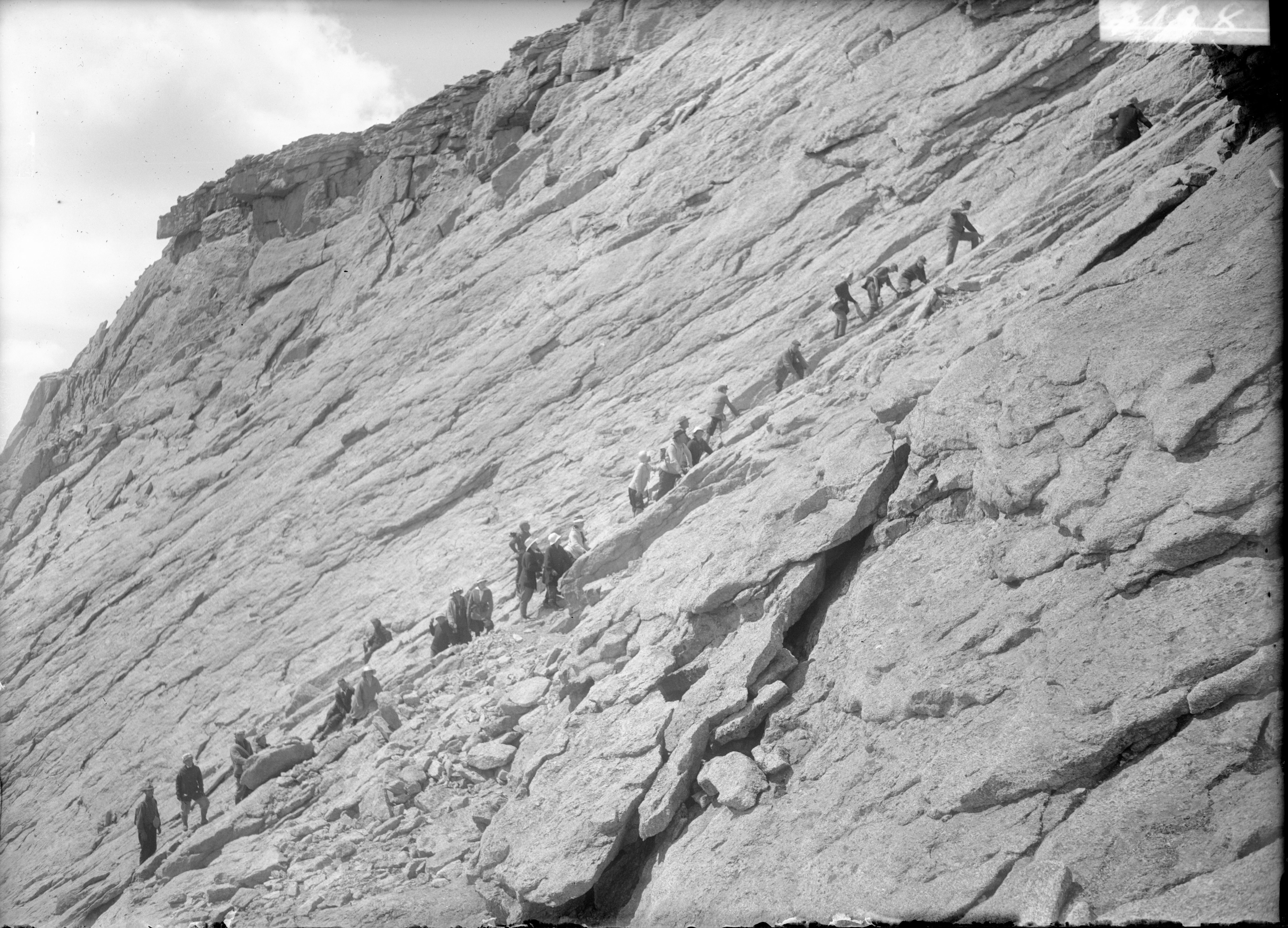
A group of hikers making the “final push” to the summit of Longs Peak, along the narrow path along a cliff. Photographed by Ed Tangen, August 17, 1916.
In stark contrast to Mount Meeker’s barely visited peak, by 1929 Longs Peak’s summit was host to a Fourth of July fireworks display, visible from Denver, revealing the colossal consequences of 1920s trail developments in transforming the peak and connecting it to the wider world. The creation of Longs Peak’s hikers’ highway was a small-scale parallel of the road improvements to the US Highways 34 and 36 to Estes Park, and the 1933 completion of Trail Ridge Road crossing the Continental Divide, providing easier access to once-remote regions.
Leave No Trace
The East Longs Peak Trail remained largely unchanged until the 1970s, despite considerably wider changes in Rocky Mountain National Park, and in other parks across the nation. The New Deal’s Civilian Conservation Corps was active in the park during the 1930s but focused on development below the timberline and caused little change to the East Longs Peak Trail. Staff and resources were redeployed for military priorities during the Second World War, resulting in limited development within the park, and the NPS’s Mission 66 program, launched in 1956 to improve nationwide national parks, focused on frontcountry areas. Only in the 1970s did the consequences of the 1964 Wilderness Act reach Longs Peak.
By then, the National Park Service's management practices had changed, with ecological and environmental concerns gaining prominence. The 1964 Wilderness Act set new guidelines for the management of wilderness areas, and the postwar boom in mass recreation meant millions of hikers were hitting the trails nationally. A decade later, “overnight use within Rocky Mountain National Park had increased 390 percent from 1967,” resulting in the deterioration of the Park’s resources. In particular, Longs Peak’s popularity surged with its easy access and esteemed “Fourteener” status, as an unprecedented wave of “peakbaggers” sought to climb all of Colorado’s 14,000-foot mountains.
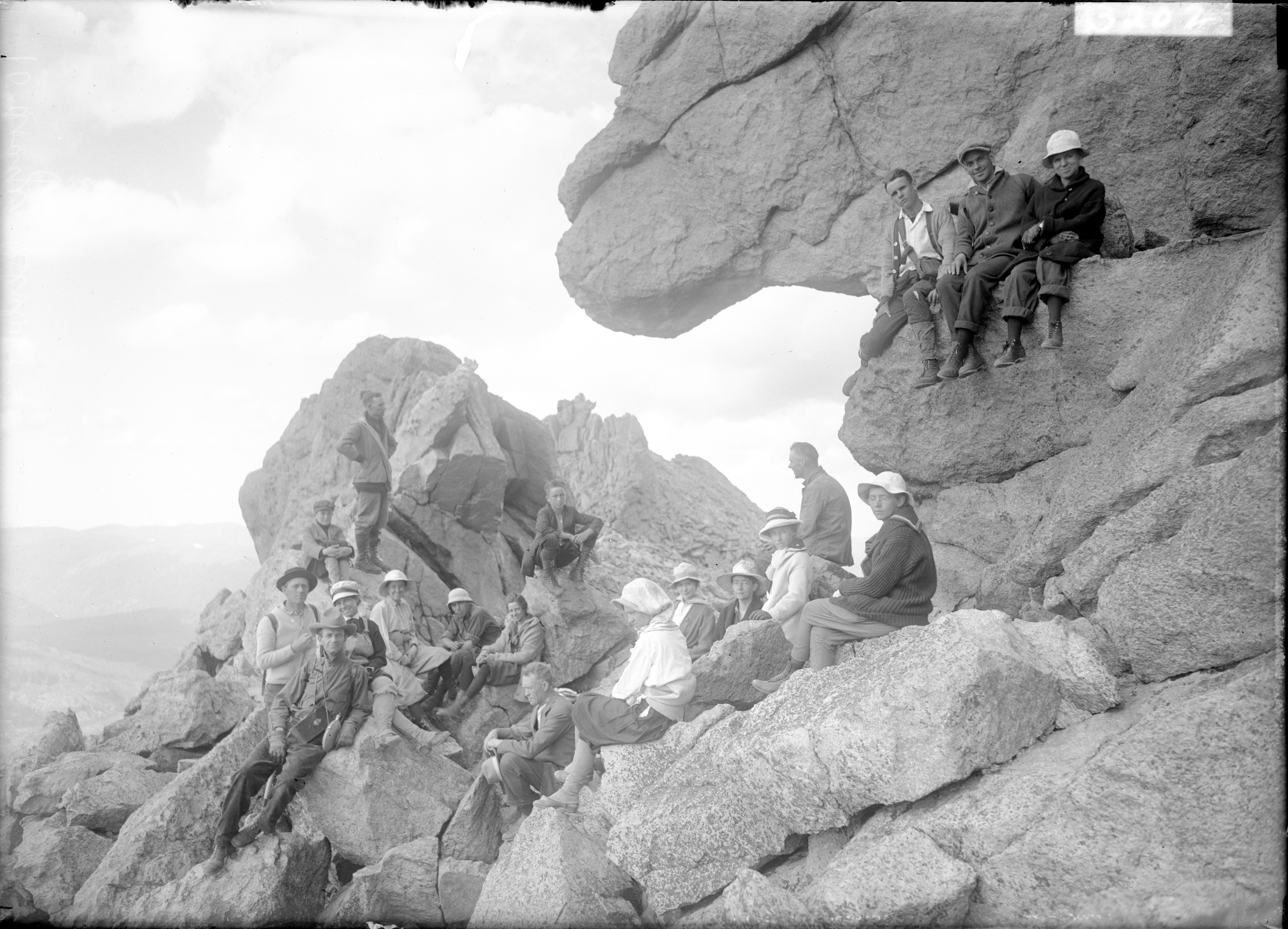
Hikers posing inside the “Key Hole”, an iconic rock structure along one of the paths to the summit of Longs Peak. Photographed by Ed Tangen, August 17, 1916.
In 1974, the park implemented a backcountry permit system, setting campsite capacity limits and requiring backcountry campsite users to register for free. The park’s 1975 Backcountry Management Plan outlined further new rules for backcountry users, such as staying on the trail, carrying out all trash, and camping “only in those campsites and on those dates listed on the permit tag,” with groups capped at seven people. Rangers enforced the new rules and permit system.
The NPS was promoting a “Leave No Trace” and minimal-impact ethic to backcountry hikers, to “provide for visitor enjoyment of the backcountry resources without unacceptable deterioration.” Entering the Park’s backcountry had become a managed, regulated, and civilized process.
Even so, the amount of hikers brought unprecedented challenges to the -Ppark. More hikers meant more excretion and, by the 1970s, human waste on Longs Peak was a problem. Hikers produced around 8,000 pounds of human waste per season in the four overflowing privies along the East Longs Peak Trail. In 1975, the NPS installed vault toilets at high-density sites, including the Boulder Field, Chasm Junction, and Jim’s Grove. Human waste was collected in eighty-gallon “honey buckets” and removed by helicopter every two to three weeks during summer. Already by 1976, however, the Park’s Acting Superintendent James W. Godbolt deemed helicopters “expensive, time consuming, and dangerous” and sought alternatives. Ironically, the helicopters’ noise threatened the very wilderness aesthetics and hiking experiences they were introduced to preserve.
Superintendent Chester L. Brooks was forced to recommend a “special provision in the designating legislation” allowing “for the continued use and maintenance of vault toilets” on Longs Peak, for its inclusion in the Park’s 239,835 acres of wilderness status. In 1979, the NPS stopped using helicopters for Longs Peak waste removal after one helicopter lost a honey bucket in flight and another crashed on the peak. After pit and incinerator toilets proved inadequate, solar toilets were installed on Longs Peak in 1983 which dehydrated most human waste, allowing pack animals to remove the remainder. Longs was a backcountry site with a frontcountry waste management problem.
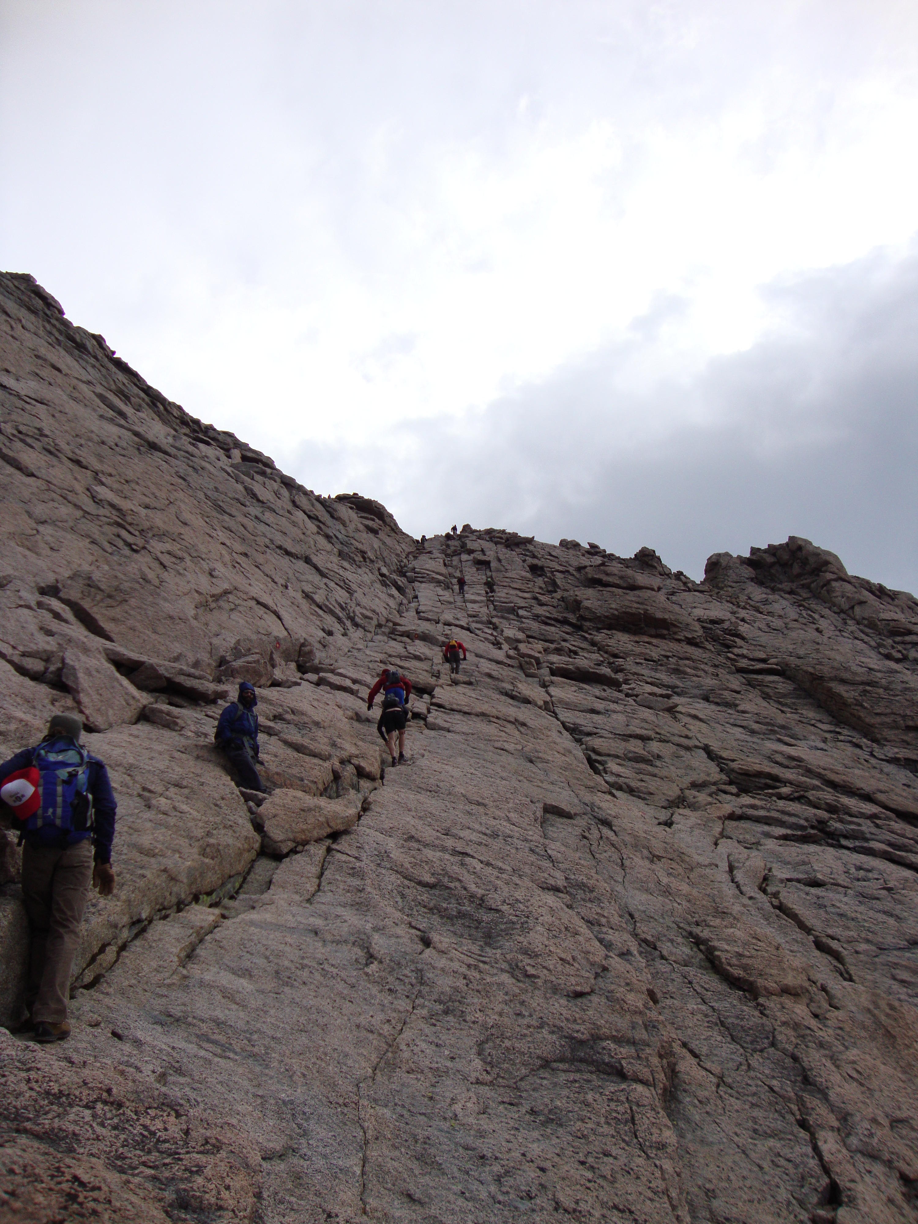
Queues of hikers climbing the Homestretch to Longs Peak’s summit, August 14, 2011.
The Cables Route had also become an issue by the 1970s. To ensure Longs Peak was “essentially free of manmade facilities” in accordance with the Wilderness Act, the NPS removed the cables in 1973. Although primarily removed for environmental reasons, there were also serious safety concerns with the route, as the steel cables were dangerous during thunderstorms, caused hour-long queues of hikers, and lured inexperienced hikers onto a still-potentially-dangerous trail. Longs Peak’s North Face returned to being a technical route leaving the Keyhole Route as the mountain's only trail for nontechnical hikers. Yet, rather than discouraging hikers, the cables’ removal merely concentrated hikers on the Keyhole Route. In 1971, 5,214 climbed Longs Peak up the Cables Route compared to 998 ascending the Keyhole Route—but in 1973, the year the cables were removed, 6,164 ascended via the Keyhole.
The 1977 Trahan Survey interviewed Longs Peak hikers and reported their biggest complaint was overcrowding, with it “not unusual for hikers to be waiting in line to ascend and descend…the upper peak areas” and with the summit clogged with “crowds of other hikers.” The survey also revealed the dramatic alteration of Longs Peak’s hiking experience, with sixty percent of hikers disapproving or strongly disapproving “commercial horse use on park trails.” Most respondents were repeat and experienced hikers ascending in groups of two to three people. The East Longs Peak Trail linked the mountain to profound nationwide transformations, with the postwar recreational boom and rising environmental concerns clearly shaping the management and hiking experience on Rocky Mountain National Park's tallest peak.
Meanwhile, the hiking experience on Mount Meeker was the polar opposite. With no toilets, trail, or telephone lines marking it, Mount Meeker required no modification or special provision to be included in the Park’s wilderness designation. Mount Meeker remained a technical ascent over rugged terrain, accessible only to mountaineers. In 1976, only twenty-six adventurous climbers attempted to ascend Mount Meeker, compared to 7,513 hikers parading up the Keyhole Route. Less than one mile, as the crow flies, separated the two tallest peaks in the park, yet their landscapes and hiking experiences were worlds apart.
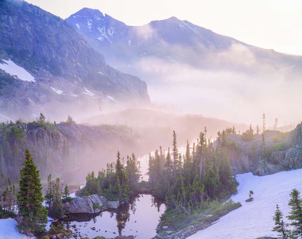
Longs Peak and Mount Meeker at sunrise. Photo by John Fielder, circa 2008.
Back to Front
Longs Peak is a cultural landscape, encompassing both natural and cultural resources. It is a place that reveals the evolution of cultural values over time. The 1870s and 1880s trail construction reflected an idealized rugged masculinity, personified in the mountain guides taking daring visitors into an “untouched” wilderness. The later trail developments reflected the transition of Longs Peak into federal management, and society’s (and the government’s) growing awareness of environmental and ecological issues. In the 1920s, the NPS worked to increase park visitation and enhanced visitor enjoyment, and prioritized safety, scenery, and access. But by the 1970s, when visitation had increased to the point of overcrowding, the focus shifted to reducing environmental degradation and preserving the mountain’s wilderness, despite human presence on it.
Yet the trail not only reflected human history, it provided hikers with the scenic views, overnight campsites, cabins or commercial hotels, and ease of passage which actively shaped human experiences as well. As Mount Meeker’s contrasting experience demonstrates, the East Longs Peak Trail was the critical artery—the hikers’ highway—which enabled access and linked Longs Peak to the surrounding road network and wider, modernizing world.
The categorization of Longs Peak as a “backcountry” destination hides the complexity of the mountain’s history. Many histories emphasize the “subdividing” of the Park into frontcountry and backcountry, contrasting the management styles in each. In her study “People and Nature on the Mountaintop,” Ruth M. Alexander goes so far as to argue the NPS only had “limited oversight on Longs,” using “relatively inexpensive and non-intrusive practices” compared to frontcountry sites. Yet dynamite-blasted trails smooth enough for a motorbike, drilled and concreted eyebolts, and vault toilets emptied by helicopter suggest far greater NPS oversight and human intrusion on the peak compared to other backcountry sites. In fact, these interventions resemble the Park’s busier frontcountry sites.
Mount Meeker stands just next door like a mirror image, reflecting back Longs Peak’s past and revealing the profound alteration of Longs Peak from a rugged, remote mountain attainable to only an intrepid few to a crowded, sign-posted peak accessible to the masses. It reveals the variety within the Park’s backcountry and suggests a more nuanced continuum which blurs the simple frontcountry and backcountry dichotomy.
Human influence has penetrated deeper into the backcountry than many realize, and recreationists seeking truly remote places might need to search harder than they expect. But as Mount Meeker continues to remind us, those places also can be hidden in plain sight.
A group of hikers posing on the precipice at the very summit of Longs Peak. Photographed by Ed Tangen, August 17, 1916.
What's in a Name?
Names of landmarks were often inconsistent in the 1800s, and even “official” names often weren’t standardized. Some locals referred to the mountain by other names, and even when Major Long’s name started being applied to the mountain, some spelled it with a possessive apostrophe (i.e. “Long’s Peak”) while others didn’t. When the federal government adopted this as the official name in 1890, they didn’t include an apostrophe. However, Coloradans’ spelling remained inconsistent for many years after that—as seen in quotes from newspapers, ads, and other publications from the 1800s and early 1900s. The name Mount Meeker, meanwhile, wasn’t suggested until 1878, and didn’t become official until 1911.